
TATRY 2IN1 POLISH AND SLOVAK TOURIST MAP 1:25 000
Discover the beauty of the Tatra Mountains with this unique 2in1 tourist map, presenting both Polish and Slovak areas. Ideal for every lover of mountain hiking, regardless of their level of advancement. With this map, no route will be scary, and planning trips will become pure pleasure. Get to know the Tatra Mountains from their best side!
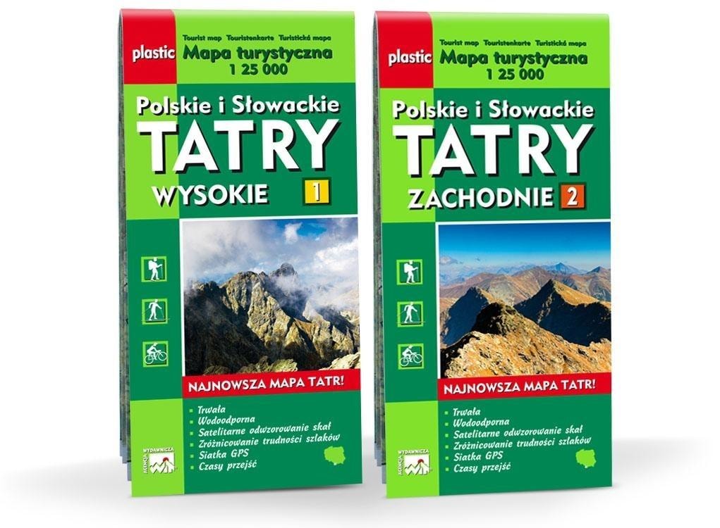
- Two sheets in one foil map case, covering the High and Western Tatras.
- Satellite mapping of rocks for precise orientation in the field.
- Differentiation of trail difficulty, making it easier to choose the right route.
- GPS grid for accurate location.
- Walking times on the trails, allowing for better trip planning.
- Practical tips for tourists and regulations applicable in national parks.
The Tatra 2in1 tourist map presents the entire Tatra Mountains on two sheets, divided according to the generally accepted principle into the High and Western Tatras. The first sheet covers the area of the High and Bielske Tatras, from the eastern border of the Tatra Mountains (Kotlina Tatranská and Tatranská Lomnica) to the Cicha Liptowska Valley in the west and from the north (Zakopane, Ždiarske sedlo, Ždiar) to Tatranská Štrba, Nová Lesná in the south. On the High Tatra sheet, in addition to the legend, there are regulations applicable in national parks.
The second sheet of the map covers the area from the east (Bystra Valley, Kasprowy Wierch, Cicha Liptowska Valley) to the western border of the Tatra Mountains (Hutianske sedlo, towns Huty, Kvačany) and from the north (Zakopane, Oravský Biely Potok) to Bobrovec, Pribilina in the south. The Western Tatra sheet contains practical tips for tourists and regulations applicable in national parks. The hiking trails on the map are divided into three difficulty categories, depending on the exposure, steepness of the path and its substrate. This division applies to trails in optimal weather conditions (dry rock, no snow cover).
Agencja Wydawnicza WIT, known for its attention to detail and high-quality materials, guarantees that this map will serve you for many seasons. By investing in this map, you are investing in your safety and comfort during mountain hikes. Regardless of whether you are an experienced tourist or are just starting your adventure in the mountains, this map will be your indispensable companion.
In winter and early spring, as well as extreme weather conditions in summer, the difficulty of the trails may change radically. In winter, hiking trails in the area of ridges and peaks are only available with alpine equipment (crampons, ice axes), and sometimes with alpine techniques. During these periods, even easy valley trails can cause many problems. Therefore, it is advisable to have a proven map with you that will help you orient yourself and choose a safe route. This map is not only a practical tool, but also an excellent gift for every mountain lover.
Specifications
| ISBN | 9788389580702 |
| Format | 185x562x25 mm |
| Binding | plastikowa |
| Year of publication | oprawa: plastikowa |
| Publisher | Agencja Wydawnicza WIT |
| Release information | Format: 185x562x25 mm |
| Type | mapa turystyczna |
| Scale | 1:25 000 |
| Region | tatra |
| Number of pages | 0 |
Tatry 2in1 tourist map - Polish and Slovak mountains are waiting to be discovered
Gross price, incl. VAT
Shipping costs:
EAN: 9788389580702